
The Oregon Coast represents a 363-mile stretch of rugged Pacific shoreline that serves as a cornerstone of the Pacific Northwest’s tourism economy and a primary case study in public land access. Unlike many coastal regions in the United States where private ownership restricts beach access, Oregon’s "People’s Coast" remains entirely public, a legacy of the 1967 Oregon Beach Bill. Today, the region faces a complex interplay of high seasonal demand, logistical challenges inherent to its geography, and an evolving hospitality market that favors localized, experiential travel. For the modern traveler, navigating this landscape requires a sophisticated understanding of transit corridors, micro-climates, and the distinct architectural and geographical offerings of the state’s various coastal enclaves.
Strategic Access and Regional Transit Logistics
The logistical gateway to the Oregon Coast is predominantly Portland International Airport (PDX), located approximately 80 to 100 miles east of the Pacific shoreline. While PDX serves as a world-class hub for international and domestic arrivals, the transition from the metropolitan center to the coast highlights a significant infrastructure gap: the lack of a comprehensive public rail or bus network. Consequently, the Oregon Coast tourism model is almost entirely dependent on personal or rental vehicles.
Travelers typically segment the coast into three primary regions, each accessed by specific mountain-pass highways that cut through the Oregon Coast Range. The Northern Coast, encompassing high-traffic destinations such as Cannon Beach, Manzanita, and Seaside, is reached via Highway 26. This route is characterized by a 90-minute drive through dense Douglas fir forests, though weekend congestion during peak summer months can significantly extend travel times.
The Central Coast, home to Lincoln City, Depoe Bay, and Newport, is serviced by Highway 18 and Highway 20. These routes facilitate access to some of the state’s most significant marine research facilities and commercial fishing hubs. Finally, Highway 101, also known as the Pacific Coast Scenic Byway, serves as the singular north-south artery connecting these communities. While Highway 101 offers unparalleled scenic vistas, it is subject to the geographical constraints of the region, including winding cliffside passes, frequent coastal fog that reduces visibility to near-zero, and sections prone to seasonal landslides. Furthermore, travelers moving into the more remote southern stretches must account for "dead zones" in cellular service, necessitating offline navigation tools and pre-planned itineraries.
Geographical Profiles: From Manzanita to Yachats
The Oregon Coast is not a monolith; its topography varies from sprawling sandy dunes to sheer basalt cliffs. This geological diversity directly dictates the type of vacation rental inventory available and the nature of the "view" provided to visitors.
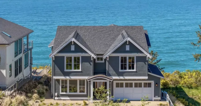
In the north, Manzanita has emerged as a premier destination for high-end architectural rentals. The town is situated at the base of Neahkahnie Mountain, where the elevation allows for hillside homes that overlook the seven-mile crescent of Neahkahnie Beach. From a real estate and tourism perspective, Manzanita represents a "curated" coastal experience, balancing luxury accommodations with a strict adherence to small-town aesthetics.
Further south, the communities of Oceanside and Yachats offer a different psychological and visual profile. Oceanside is built into a steep amphitheater-like hillside, providing panoramic views of the Three Arch Rocks National Wildlife Refuge. Its relative isolation from the main Highway 101 artery preserves a quieter, more "raw" coastal atmosphere. Yachats, frequently referred to as the "Gem of the Oregon Coast," is characterized by its black basalt shoreline rather than sandy beaches. Here, the draw is the violent and majestic interaction between the Pacific and the volcanic rock, providing a more dramatic, less-developed vista that appeals to travelers seeking solitude over traditional resort amenities.
The Chronology of Seasonal Migration and Climate Patterns
Tourism on the Oregon Coast does not follow a traditional "high and low" season binary; instead, it operates on a four-tiered seasonal calendar, each with distinct meteorological and biological characteristics.
Summer (July – September): The Peak Economic Driver
The summer months represent the period of maximum sunlight and the lowest probability of precipitation. During this window, temperatures remain mild, rarely exceeding 75 degrees Fahrenheit, providing a cool refuge for those fleeing the heat of the Willamette Valley or the American Southwest. This period sees the highest occupancy rates for vacation rentals and the greatest strain on local infrastructure. Data from regional tourism boards indicates that nearly 50% of annual visitor spending occurs during this three-month window.
Fall (October – Early November): The Transition Period
Known by locals as "Second Summer," the early fall often brings the clearest skies of the year. The inland heat dissipates, reducing the pressure differential that causes coastal fog. This period is favored by hikers and photographers, as the crowds of summer depart, and the foliage in the Coast Range begins its shift toward autumnal hues.
Winter (Late November – February): The Storm-Watching Phenomenon
Once considered a "dead" season for tourism, winter has been rebranded as "Storm-Watching Season." This period is defined by low-pressure systems moving in from the North Pacific, bringing towering swells and winds that can exceed 60 miles per hour. This has created a niche market for "fireside tourism," where high-end rentals with floor-to-ceiling windows become the primary attraction. The economic impact of storm-watching has helped stabilize the year-round economy for coastal businesses that previously struggled during the winter months.
Spring (March – May): Biological Renewal and Whale Migration
Spring marks a period of significant ecological activity. The biannual gray whale migration is a primary draw, as approximately 20,000 whales pass by the coast on their way to Alaskan feeding grounds. The Oregon Parks and Recreation Department typically hosts "Whale Watching Spoken Here" programs during late March, placing volunteers at various headlands to assist the public in spotting the marine mammals. Additionally, spring tides reveal vibrant marine life in tide pools, particularly at locations like Haystack Rock in Cannon Beach and Cape Perpetua near Yachats.
Economic Implications and the Short-Term Rental Market
The rise of digital booking platforms has fundamentally altered the Oregon Coast’s housing and tourism economy. In many coastal towns, the density of vacation rentals has become a point of legislative contention. While these rentals provide the necessary infrastructure to house the millions of visitors who support the local service economy, they also place upward pressure on real estate prices, often pricing out the local workforce.
In response, several coastal municipalities have implemented caps on the number of short-term rental (STR) licenses or established "buffer zones" to prevent the hollowing out of residential neighborhoods. Analysts suggest that the Oregon Coast is currently in a "maturation phase" of its tourism cycle, where the focus is shifting from increasing the sheer volume of visitors to managing the sustainability of the visitor experience. This includes initiatives to promote travel during the "shoulder seasons" (spring and fall) to alleviate the summer burden on small-town resources.
Safety, Conservation, and Environmental Stewardship
The Oregon Coast is a dynamic and occasionally hazardous environment, a fact that official tourism bodies are increasingly emphasizing. The region is subject to "King Tides"—exceptionally high tides that can cause localized flooding and dangerous beach conditions. Furthermore, the threat of "sneaker waves"—disproportionately large coastal waves that can surge much further up the beach than expected—poses a perennial safety risk to uninformed tourists.
Environmental conservation also remains a top priority. The tide pools and rocky intertidal zones are fragile ecosystems protected by state law. Visitors are encouraged to practice "tide pool etiquette," which involves observing marine life without disturbing or removing it. The balance between maintaining the coast as a public playground and preserving its ecological integrity is a central theme in the state’s long-term management plan.
Conclusion: A Resilient Tourism Frontier
The Oregon Coast continues to thrive as a premier destination by leveraging its natural drama and its commitment to public access. From the cinematic overlooks of Manzanita to the whale-watching hubs of the central coast, the region offers a diverse array of experiences that are deeply tied to the rhythms of the Pacific Ocean. As the travel industry moves toward more sustainable and localized models, the Oregon Coast stands as a resilient example of how a region can maintain its rugged identity while accommodating the logistical and economic demands of 21st-century tourism. Travelers who navigate this coastline with an appreciation for its seasonal nuances and logistical realities are rewarded with one of the most profound coastal experiences in North America.

0 Comments